Peri-Urban Gateways: Binding Stations to Community and Heritage
Spatial Planning and Infrastructure Design Studio (2023)
Master Program - 1st Semester
A Group Project With Elisa Cribellati, Patrizia Leardi, and Varsha Sanath Kumar
Studio Main Goals
Rethinking and redesigning suburban railway stations as the hotspot of the entire metropolitan system’s reorganization, experimenting Transit Oriented Development (TOD) approaches. Attention will be paid to design solutions for enhancing the existing suburban railway stations, as the epicenter for territorial regeneration and car-dependency reduction, fostering adaptation and forwarding climate neutrality by combining citizen mobility behavioral changes, emission reduction, ecosystem provisioning.
Context
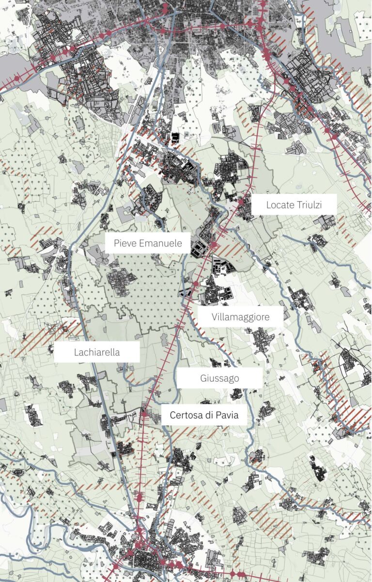
The scope of analysis extends along the route of the SR13 railway line between Milan and Pavia.
There are 4 stations on the SR13 line that will subsequently be analysed: Pieve Emanuele, Locate Triulzi, Villamaggiore and Certosa di Pavia.
The analysis of the territory made it possible to identify the urbanized fabric and the areas with landscape value and to begin an initial mapping of the already existing mobility infrastructures.
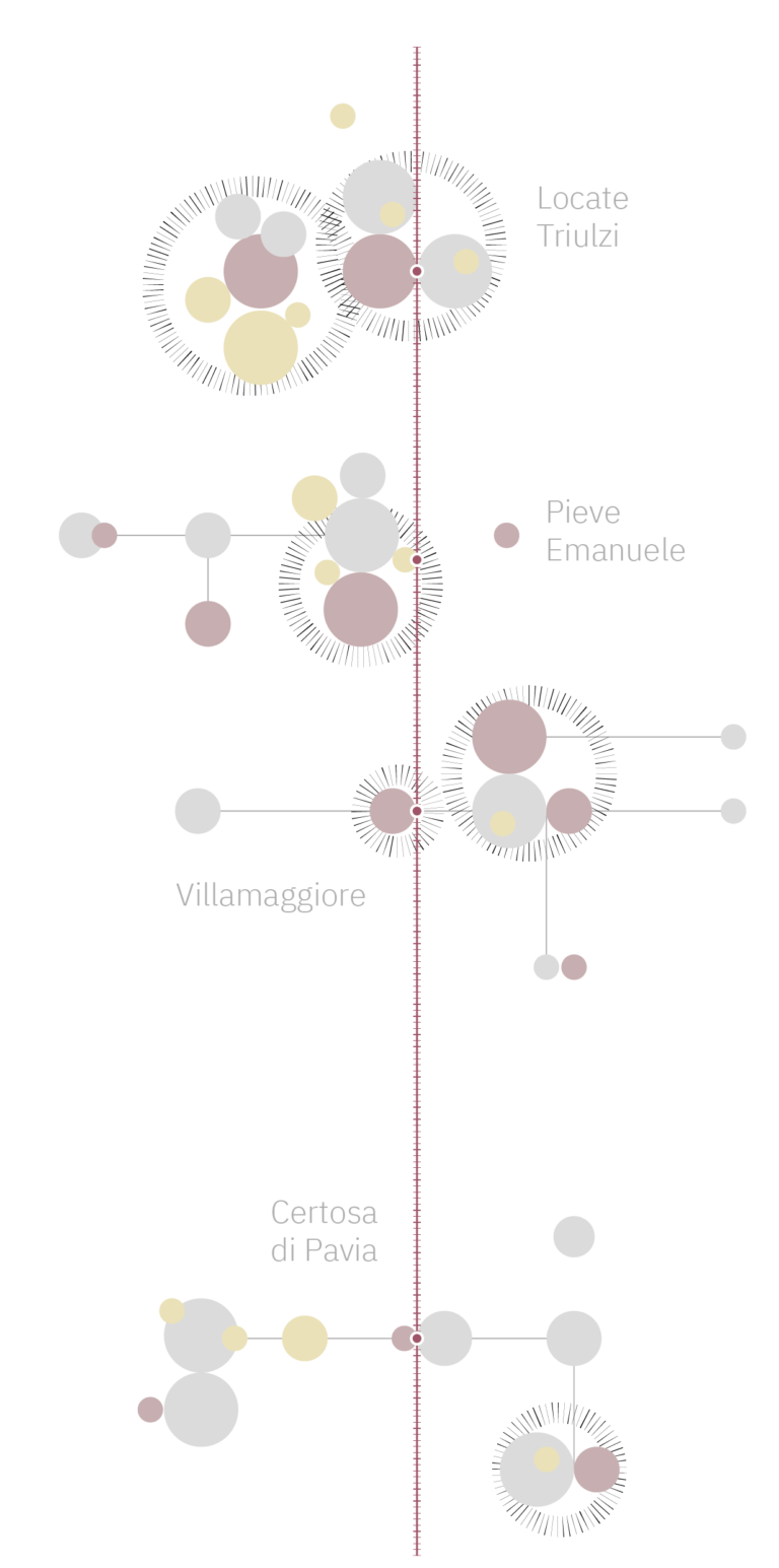
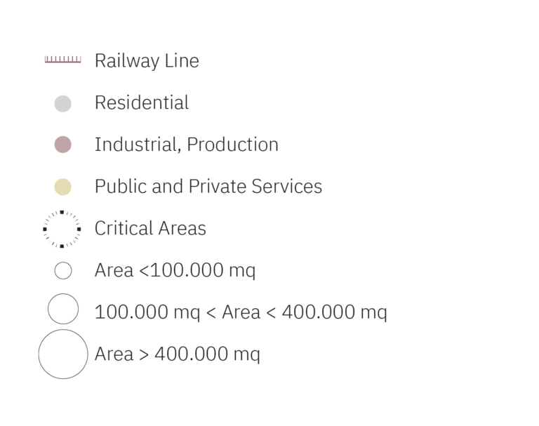
Land Use Distribution Diagram
The quality of life of residents in peri-urban areas depends on the presence of services nearby (15 minutes walking is the maximum) and on how much distance is put between them and industrial, productive or logistic centers.
The impact of logistic centers is definitely negative in terms of: quality of air, safety of the streets, land use consumption, traffic congestion, pollution, compromised water ecosystem, and so on.
It is possible to observe that the catchment area defined previously presents these critics: residences are often facing the same roads trucks use to access the sheds, with no filter in between or if any, weak, oversized and underused.
SWOT ANALYSIS
Locate Triulzi
Strength
Commercial centre near the rail-line acting as an attractor
Stations are inclusive of differently abled
Walkability within the village
Weakness
Large carpark area promoting car usage
Urbanisation towards one side of the station
The urbanisation spread apart with poor connectivity to the station
Opportunity
Close to nearby villages and Milan central
Density is higher compared to other villages
Threat
Very few public transport connectivity to the city centre
Pieve Emanuelle
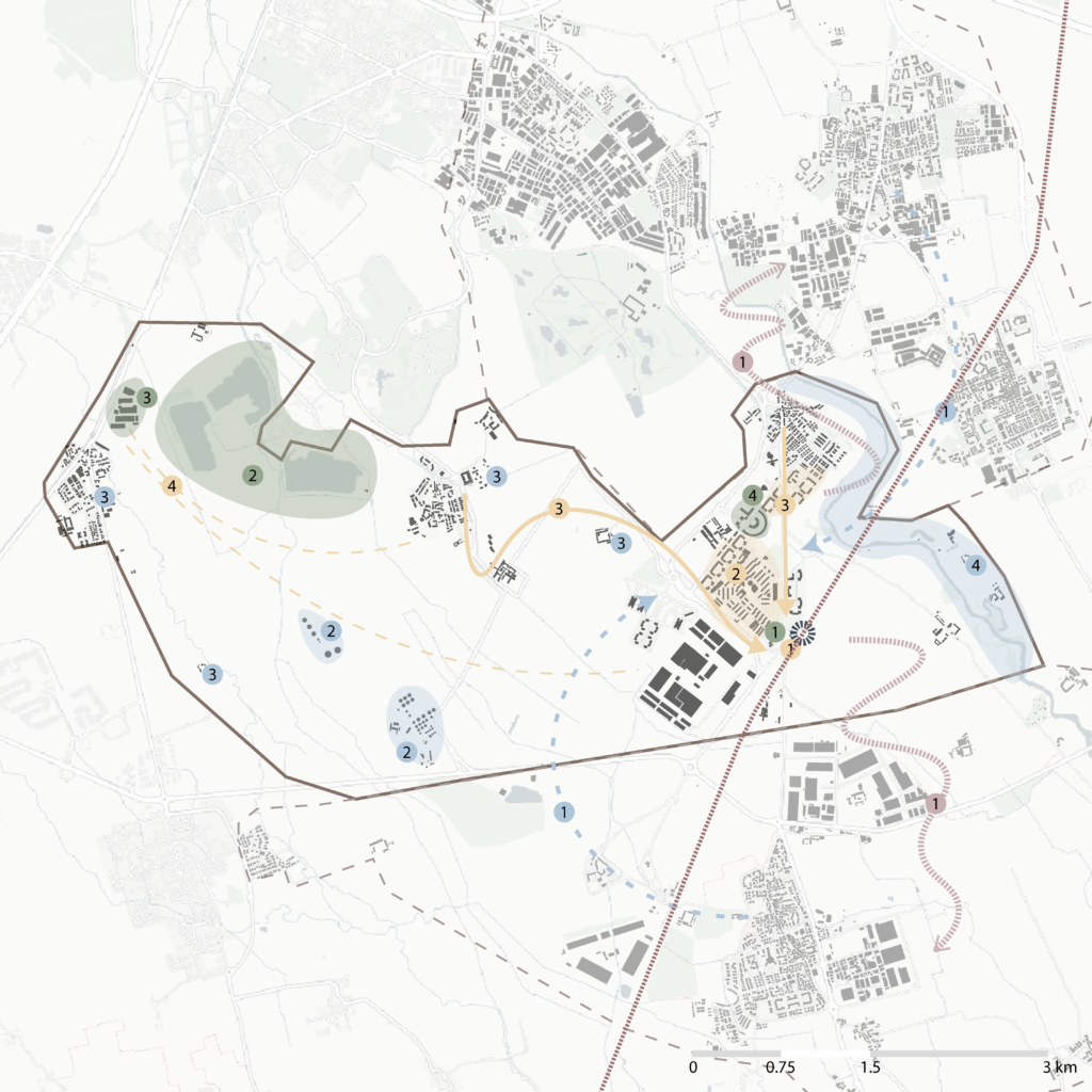
Strength
Have community garden to make the area self sufficient
Lake that have the potential to attract people
Factory that might be the main job for the villagers
Weakness
Huge carpark that worsen pedestrian connectivity
Not having mixed used building
Some areas do not have connectivity to the other area near station
Opportunity
Near to other villages (Locate Truzi and Villamaggiore)
Many cascinas that can be used as attractive places
Threat
Other villages are more livable and attractive
Villamaggiore
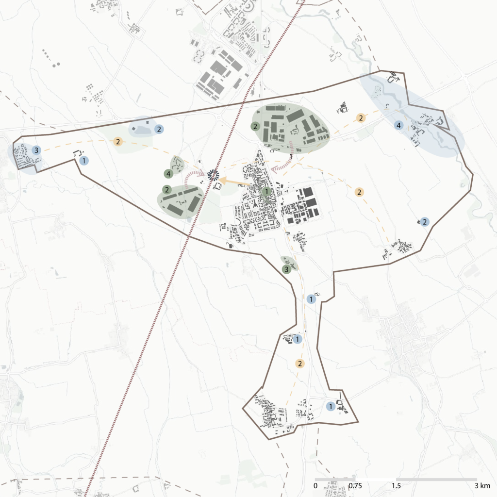
Strength
Good, lively neighborhood with complete facilities
Factory that might be the main job for the villagers
Hotels that can accommodate visitors
Weakness
Long, boring walk to the station
Some areas are very far to the station (non-walkable)
Opportunity
Many cascinas that can be used as attractive places
Lake that can be used as tourist spots
Nearest other settlements that can be connected to the station
Threat
If the factory wants to expand, it will be bad for the settlement areas
Certosa di Pavia
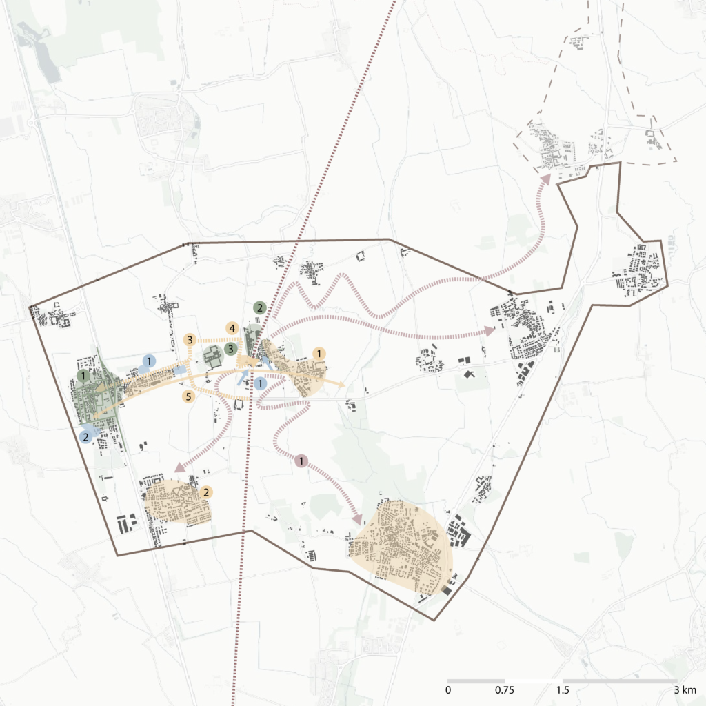
Strength
Mixed land use with basic amenities within walking distance
Industry close to the station allowing easy transport
Largest Monastery acting as an attractor
Weakness
Development is linear and scattered manner
Disconnected to the railway line
Car centred single road to the station
Opportunity
Open space available to allow public shuttle bus connectivity to the station
Demography of the town is mostly elderly citizens
Threat
Station is disconnected from the nearby villages of the province and other provinces
The Aims of The Project
Putting the human dimension first in the development of the territories between Milan and Pavia.
The goal of the project is to implement the role of the stations in a complex system of tracks that can facilitate life and travel within the core adjacent to the station but also to extend the connection between the stations and the surrounding area, mobilizing the reuse of historic buildings for the community first and foremost and for anyone who wants to get to know the area.
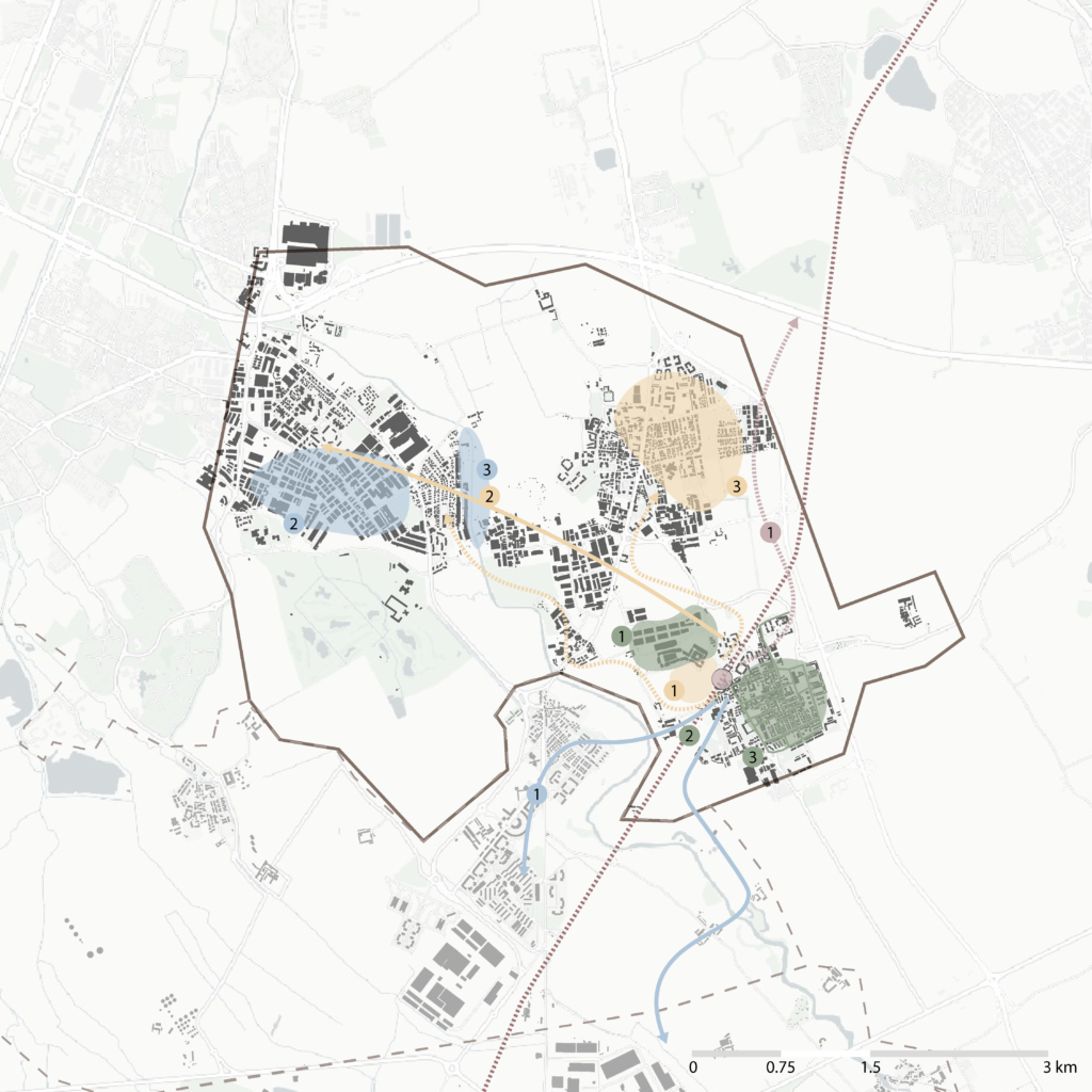
Strategy: 3 Scale
The development of the design strategy wants to start from the station and the city context in which it is inserted (scale 1), and then develop through the main road axes (scale 2) connecting to the territory, until it reaches pivotal places and unused buildings and strategic points to encourage the implementation of spaces for community, leisure, work and study.

SCALE 1
Neighborhood Areas
Implementing strategies to improve liveability, mobility, heritage and environment of the station and area around the station
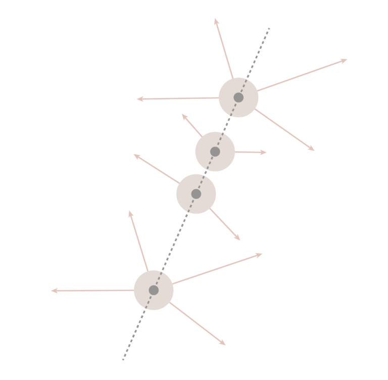
SCALE 2
Connecting The Territory
Improve connectivity outside to areas of the neighborhood to connect the gateways to our territories by sustainable means
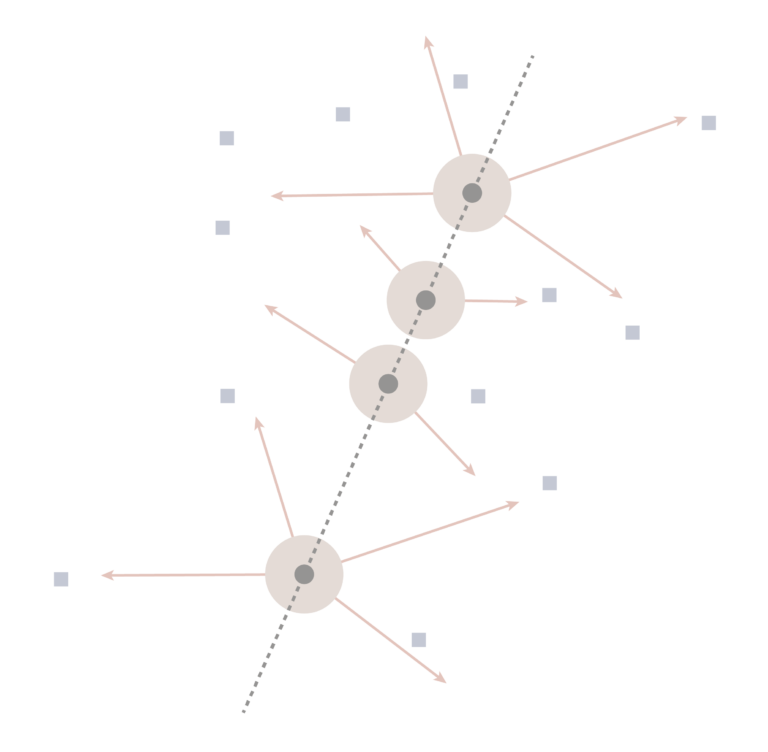
SCALE 3
Human and Green Heritage
Promoting agri-tourism, improving livability and points of interest by sustainable mobility by repurposing and preserving the heritage
Strategic Map
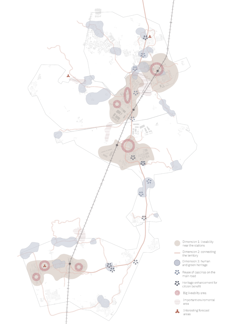
The purpose of the strategic map is to begin to focus on the study of the area and the possibilities for developing a pathway and facilitated connection between the residential, work and leisure areas and the four stations of the area under study.
The development of a strategy capable of connecting the rural and agricultural territories between the two cities of Milan and Pavia began with the four railway stations on the S13 line and the surrounding area: through the first strategic dimension, the group began working on spaces in the neighborhood areas near the stations, implementing strategies for the livability of public areas, internal and proximity mobility.
Through dimension 2 it was possible to assume an increase in connections outside the residential areas close to the station, thus promoting the connection of stations, understood as gateways, and the surrounding area.
In the third and final dimension through the development of connections between the station and the non-neighboring territory, it was possible to identify areas of interest from a naturalistic point of view and beyond.
Have been selected areas containing buildings that are important from a historical point of view, such as farmhouses, underused or abandoned, capable of providing reusable areas that can be used by the community, such as leisure areas, coworking and teaching areas.
Area of Interest
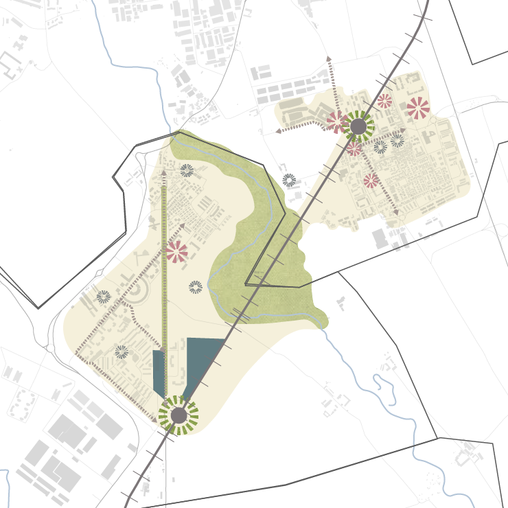
Through the strategy map, it was possible to identify an area to develop project ideas.
The area is located between the municipalities of Locate Triulzi and Pieve Emanuele. It was chosen because of the proximity of the two municipalities to a very large oasis located just between the two municipalities. It is an area where there are industries, a large shopping center, and numerous residential complexes. The idea is to create a connection between two large settlements through the green oasis as well as improve vibrancy around the station neighborhood.
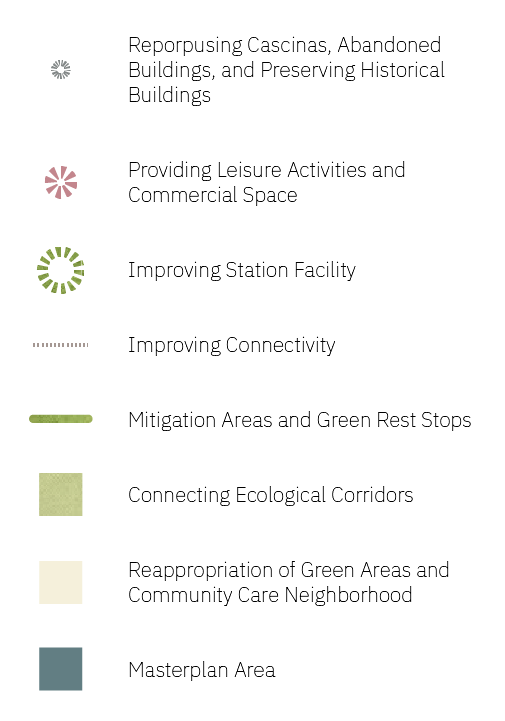
The Masterplan area is intended to connect the station and the town of Pieve Emanuele with the nature area that lies between the Locate Triulzi and Pieve Emanuele areas.
The Masterplan

The master plan revolves around a strategic overhaul of the station, aiming to position it not only as a central arrival and departure point but also as a dynamic community hub for the local population. The project’s primary objective is to prioritize the human aspect in the development of the region between Milan and Pavia, characterized by agricultural fields and small villages along the S13 route. Emphasizing the station’s role as a comprehensive system, the plan envisions a car-free area with various spaces for waiting, community interaction, and family activities, extending its influence to the core of Pieve Emanuele and the surrounding context.
Starting from the station, the design extends to adjacent areas, incorporating a connected green system and an ecological corridor linking to the oasis area in Pieve Emanuele and Locate Triulzi. Human-centric design is crucial in these spaces, with the repurposing of an abandoned building, creation of multifunctional areas, and the establishment of a comprehensive school, services, and four new buildings within a green landscape. The master plan’s success hinges on enhancing connections between the station and surrounding zones, achieved through cycle paths, pedestrian routes, public transport, altered car routes, and reduced private parking spaces. By prioritizing pedestrians and cyclists in the connection area, including the naturalistic zone, the plan encourages slow mobility, fostering safety and community well-being.
Green Spaces
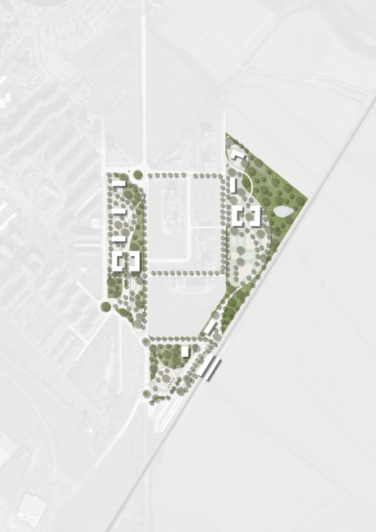
Establishing a green buffer zone along the railway not only mitigates noise and air pollution from train operations but also enhances the area’s aesthetics. This multifunctional buffer acts as a sound and pollution barrier while contributing to the overall visual appeal. Additionally, creating a vibrant oasis serves as a seamless link between built and agricultural areas, promoting biodiversity for ecological balance. To optimize permeable surfaces, incorporating permeable concrete for pedestrian areas ensures resilient urban infrastructures. Integrating a thoughtfully landscaped environment with strategically planted trees along pedestrian and cycling paths not only acts as natural wayfinding elements but also provides shade for a healthier and more enjoyable environment.
Bus Line
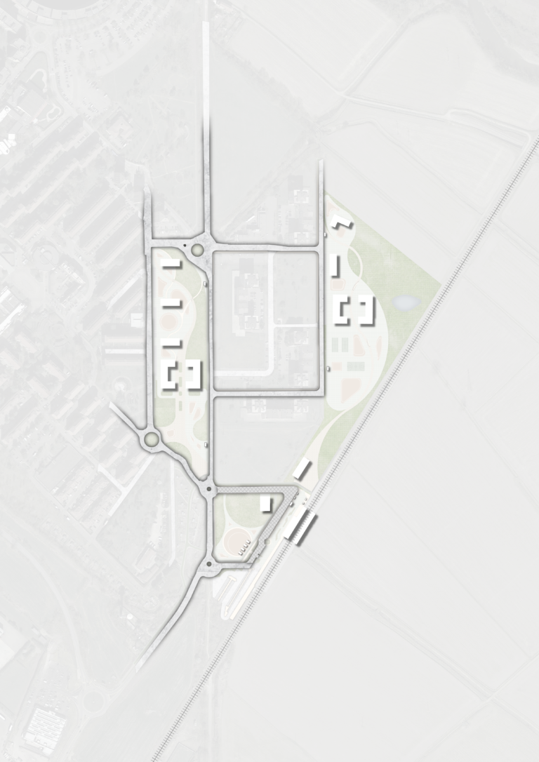
Establish an extensive bus network connecting the station, masterplan zones, and nearby settlements to diminish reliance on cars. Streamline and adjust existing bus routes for optimal coverage with minimal road usage, ensuring efficiency. Introduce strategically planned new bus routes to augment coverage, contributing to a more inclusive and accessible public transportation network.
Cycling Path
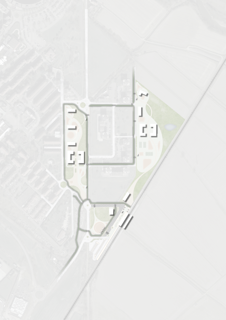
Create an all-encompassing cycling infrastructure connecting the station, masterplan regions, and neighboring settlements to alleviate dependence on cars. Implement strategically designed new cycling paths to augment area coverage, fostering a more extensive and accessible cycling network. Enhance the integration of cycling facilities by relocating the existing bike park closer to the station, ensuring better accessibility and convenience for users.
Pedestrian Path
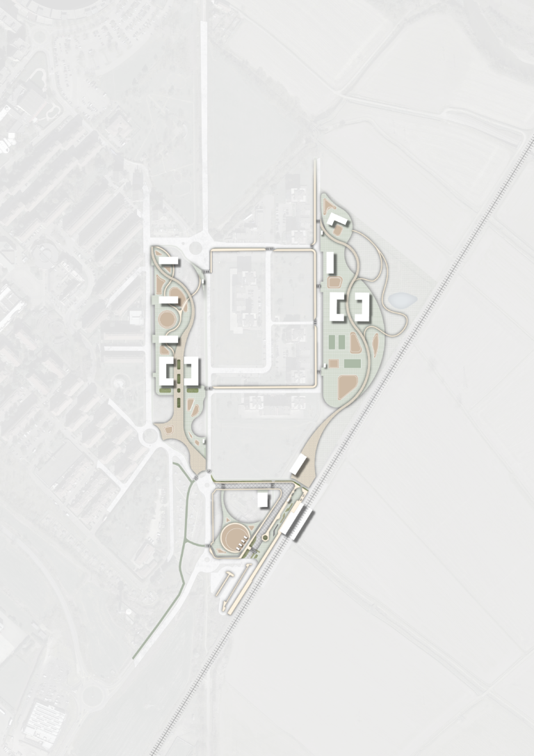
Establish a unified pedestrian path network connecting the central station, masterplan area, and adjacent settlements to minimize car dependency. Craft a pedestrian-friendly ambiance, especially in proximity to the station, featuring plazas, green spaces, and amenities. Seamlessly integrate the pedestrian path with cycling lanes and bus routes, promoting public transport and non-motorized modes of transportation over cars for residents and visitors. Repurpose the existing bus road near the station into a shared surface and plaza, prioritizing pedestrians while accommodating public transportation and cyclists, fostering a pedestrian-centric environment.